The Levada da Serra do Faial once brought water to the Caminho do Meio - the old road on which the Botanical Garden is located - from the Levada do Furado which flows through Ribeiro Frio. The initial section from Funchal was abandoned (though the footpath remains) and the water diverted down a new downhill course to the Levada dos Tornos when the latter was constructed. Beyond Camacha, significant sections are now road or footpath. Being at a relatively high elevation, you can experience either magnificent distant views or an obscure blanket of low cloud - or alternating periods of both!
The walk described here is the section between Funchal (Caminho do Meio) and Camacha (Estrada dos Casais de Além). You can go beyond Camacha to Santo da Serra or even Portela/Ribeiro Frio.
The marked starting point of this walk (or the point nearest to
Funchal) is a little to the north-east of the Estádio da Madeira, off
the old, cobbled, Caminho do Meio. The levada runs, mostly through forest, to Camacha.
For much of its course, it follows roughly the same route as the
Levada dos Tornos, although at a significantly higher elevation - and the water flows westwards rather than eastwards. It intersects
the Levada do Blandy - which runs roughly from north to south with a
steep fall - and a nearby path (the Caminho do Pico do Infante) offers a route down to the
Levada dos Tornos.
As mentioned, there is no sign of water along the initial stretch of the path, nor of the levada ever having existed, though if you're fortunate with the weather there are, by way of compensation, views of Funchal. There was significant
logging going on when I visited, meaning the uphill areas were
rather bare. The valley immediately below is used for agriculture.

As you enter the trees, you come to the point at which the water has been diverted to the later
Levada dos Tornos. There's no convenient walking route at this point to link the two, but there is a little further on.
The construction of the new levada - and of the hydroelectric plant at Fajã da Nogueira led to a significant restructuring and curtailment of the Levada da Serra do Faial.
The path, however, is maintained throughout, as occasional tree falls and rock falls may be encountered.

")
One of the features of the levada is a complex
junction where it crosses the Levada do Blandy (the earlier levada that was built to meet the copious demands of the Quinta do Palheiro).
There's a series of
gullies, tunnels and pipes that allow the water to be sent in a variety
of directions, forming a miniature "spaghetti junction".


A
signpost at this point confirms your east-west route options, but there
is also a north-south path: the remains of the old, cobbled, Caminho do Pico do Infante crosses the levada at this point. You can follow it downhill with relative ease towards the
Levada dos Tornos (a broken tree currently marks
the southward path). There is also an unmarked uphill route north to the Pico do Infante - though you may find yourself surrounded by motorcycle scramblers - where you can cross to the Caminho do Meio and return to the starting point of the levada if you're feeling more adventurous and suitably equipped.

If you want to go down to the Levada dos Tornos, follow the path downhill you'll join a paved road: follow it downhill until you come to a main road. As you cross
it, there's a sign to indicate the direction you need to follow. A short
distance down the road you'll see a rather unprepossessing warehouse at
the point the Levada dos Tornos crosses the road.
Continuing in the direction of Camacha, you have views of the Quinta do Palheiro, from the opposite side.
There are also constant signs of the agriculture supplied by the waters of the levada.
As you approach Camacha, bucolic calm is replaced by signs of suburbia. You also need to keep a look out as the levada is used by guided bicycle tours and you may find a couple of dozen cyclists bearing down on you without warning.
However, if you're fortunate, your arrival in Camcha will be serene.
Getting there
If you're arriving by car, one option is to take the ER203 to
the point at which the road is crossed by the levada. There is now a small area of car parking giving you the option to park and head either towards
Camacha and beyond or towards Funchal. The entry point to the levada in Camacha is on a narrow road used by buses and coaches so not ideal for parking. There is parking in the centre of Camacha but it's a steepish hike up to the levada.
If you want to start from the Funchal end, there is (paid) parking at the Estádio da Madeira which appears to be open to the public and from where there is an exit directly onto the Caminho do Meio, though there is still a significant climb up to the start of the levada. See the directions below for getting from the Caminho do Meio to the start of the levada.
By public transport, your best option is likely the CAM (formerly Interurban HF) 111 service to Achadinha (departs from the bus station by the cable car in Funchal). There are only a few services a day, but if you get off at the
penultimate stop (or go to the terminus and walk back a short distance) you will be almost directly adjacent to the levada access steps. There are more frequent services to the centre of Camacha, but you'll arrive at a lower elevation and need to walk up.
The 111 is worth taking for the views, though if you're of a nervous disposition you might want to enjoy them from the left hand side of the bus. The 111 makes a detour into Ribeirinha where it performs a heroic three-point turn (the road becomes too narrow for it to continue) and travels back along the route of its arrival, so even if you have chosen the left hand side of the bus, sight of the precarious parapet of precipitous peril will be unavoidable for this part of the journey.
From Funchal, you'll have a climb of about 200m over a distance of around 1km from the nearest practical public transport, so if you prefer to walk downhill, make this the endpoint of your journey.
 |
| © OpenStreetMap
contributors |
By bus from Funchal, it's easiest to arrive via the
Levada dos Tornos - you'll find transport information on the linked page. Once you've arrived, head along the levada away from Curral dos Romeiros.
The
first public road the levada crosses is the Caminho do Meio. If you
head uphill along the road, you'll come to the terminus of the HF 94 bus
and the road forks: you need the fork to the right that continues
upwards. After a while you'll pass the Estádio da Madeira football
ground and reach the Caminho dos Pretos.

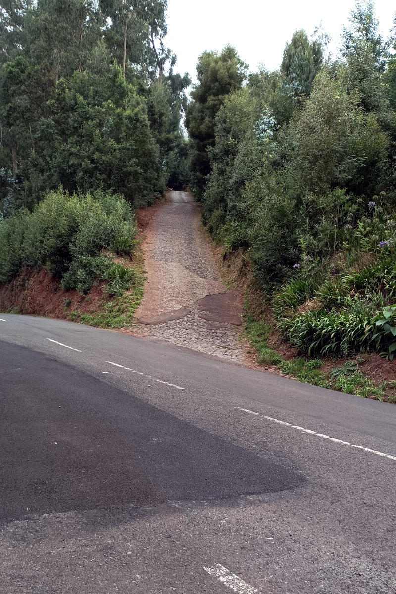
The Caminho do Meio continues on the other side of Caminho dos Pretos (though it's labelled
Caminho do Pico do Infante on OpenStreetMaps), but this is now the original, cobbled surface - and this section of road is absent from Google Maps. It is used by
vehicles, so take care, especially at blind corners. The path leads
uphill, past some rural dwellings and the levada runs off to the
south-east (on the right as you climb the hill) where the sign appears.
You can obviously return in the reverse direction, but check in advance on the HF 29 schedule. If you find yourself with time to spare, you can follow the Levada dos Tornos back towards Curral dos Romeiros where you can also pick up the 29 bus, or take the (strenuous) walk across to Monte. You could also walk in the opposite direction (back towards Camacha) where there are other transport options en route - though none of them terribly frequent. You can also walk down to the Botanic Garden and pick up a bus there, but the road is very steep.


 As you enter the trees, you come to the point at which the water has been diverted to the later Levada dos Tornos. There's no convenient walking route at this point to link the two, but there is a little further on.

")
")
")

 A
signpost at this point confirms your east-west route options, but there
is also a north-south path: the remains of the old, cobbled, Caminho do Pico do Infante crosses the levada at this point. You can follow it downhill with relative ease towards the Levada dos Tornos (a broken tree currently marks
the southward path). There is also an unmarked uphill route north to the Pico do Infante - though you may find yourself surrounded by motorcycle scramblers - where you can cross to the Caminho do Meio and return to the starting point of the levada if you're feeling more adventurous and suitably equipped.
A
signpost at this point confirms your east-west route options, but there
is also a north-south path: the remains of the old, cobbled, Caminho do Pico do Infante crosses the levada at this point. You can follow it downhill with relative ease towards the Levada dos Tornos (a broken tree currently marks
the southward path). There is also an unmarked uphill route north to the Pico do Infante - though you may find yourself surrounded by motorcycle scramblers - where you can cross to the Caminho do Meio and return to the starting point of the levada if you're feeling more adventurous and suitably equipped.
 If you want to go down to the Levada dos Tornos, follow the path downhill you'll join a paved road: follow it downhill until you come to a main road. As you cross
it, there's a sign to indicate the direction you need to follow. A short
distance down the road you'll see a rather unprepossessing warehouse at
the point the Levada dos Tornos crosses the road.
If you want to go down to the Levada dos Tornos, follow the path downhill you'll join a paved road: follow it downhill until you come to a main road. As you cross
it, there's a sign to indicate the direction you need to follow. A short
distance down the road you'll see a rather unprepossessing warehouse at
the point the Levada dos Tornos crosses the road. 


 The Caminho do Meio continues on the other side of Caminho dos Pretos (though it's labelled Caminho do Pico do Infante on OpenStreetMaps), but this is now the original, cobbled surface - and this section of road is absent from Google Maps. It is used by
vehicles, so take care, especially at blind corners. The path leads
uphill, past some rural dwellings and the levada runs off to the
south-east (on the right as you climb the hill) where the sign appears.
The Caminho do Meio continues on the other side of Caminho dos Pretos (though it's labelled Caminho do Pico do Infante on OpenStreetMaps), but this is now the original, cobbled surface - and this section of road is absent from Google Maps. It is used by
vehicles, so take care, especially at blind corners. The path leads
uphill, past some rural dwellings and the levada runs off to the
south-east (on the right as you climb the hill) where the sign appears.